 |
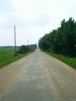
Pre-66 Ribbon Pavement, Miami, OK
- While legislation for public
highways
first appeared in 1916, with revisions in 1921, it was not until
Congress enacted an even more comprehensive version of the act in 1925
that the government executed its plan for national highway
construction. Officially, the numerical designation 66 was assigned to
the Chicago-to-Los Angeles route in the summer of 1926. With that
designation came its acknowledgment as one of the nation's principal
east-west arteries. For the most part, U.S. 66 was just an assignment
of a number to an already existing network of state-managed roads, most
of which were in poor condition.
- One outstanding
example of the highway in its early form is the 3.5 mile section near
Miami, Oklahoma, estimated to have been constructed between 1919 and
1924.
[United States. Department of the Interior. National Park
Service. Special
Resource Study: Route 66. Online. 1995. Available http://www.cr.nps.gov/rt66/SpecialResourceStudy.pdf.]
|
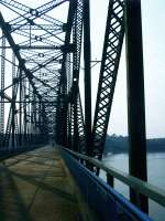 |
Chain of Rocks Bridge
- Many of Missouri’s
bridges were constructed in the
1920s.
Undoubtedly, the most famous of these bridges is the Chain of Rocks
Bridge, which opened in 1929. The one-mile bridge, which spans
the Mississippi River between Madison, Illinois and St. Louis, was
constructed as a private venture by the Chain of Rocks and Kingshighway
Bridge Company. Built as a toll bridge to bring travelers into
St. Louis from the north, the Chain of Rocks Bridge became a free
crossing in 1966. The bridge, which is the 12th longest
continuous span bridge in the world, became notorious for delays caused
by the 30-degree bend in its middle span. After the City of
Madison purchased it, the Chain of Rocks Bridge was incorporated into
the third routing of U.S. 66 through St. Louis in 1931. In 1965,
U.S. 66 traffic was routed over the new I-270 bridge. The Chain
of Rocks Bridge closed for repairs in 1970 and never reopened to
automobile traffic. In recent years, it has been reopened for
hiking and biking, connecting Missouri and Illinois trails.
[Snider, Becky L, et al.
"Route 66 in Missouri." National Park
Service Cultural Resources. Online. 2003. Available http://www.cr.nps.gov/rt66/HistSig/
MissouriContext.htm.]
- Bridge lanes over
the Mississippi River have declined from 22 lanes in
the 1960s to 12 lanes in 2003. A group of state and local officials and
business people are supporting a proposal to build a new eight-lane
bridge over the Mississippi about one mile north of downtown St. Louis.
That project is dependent on Missouri and Illinois receiving federal
funding in the upcoming Senate transportation bill.
["McKinley Bridge Could Be
Repaired, Open by 2006." St. Louis Business Journal n. seq. (16
June 2003): 7 pars. Online. Internet. 14 Aug. 2005. Available http://stlouis.bizjournals.com/stlouis/stories/
2003/06/16/daily16.html.]
|
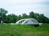 |
Rainbow Bridge, Riverton, KS
- In 1992,
construction of a softer curve
bypassed the Rainbow Bridge at Brush Creek. After a hard fight by
the Kansas Route 66 Association, County officials agreed to leave
the Brush Creek Bridge standing as a historic landmark.
[Weiser, Kathy R. "Legendary Route 66." Legends of America
n. seq. (2004): n. pag. Online. Internet. 9 Aug. 2005. Available http://www.legendsofamerica.com/66-Mainpage.html.]
|
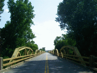 |
Pony Bridge, El Reno, OK
- The Pony Bridge at
the Canadian River is 3944.33 feet long and contains 38 pony trusses.
It was completed July 1, 1933.
[Randall, Guy. "Shadows of Old Route 66." The Road
Wanderer n. seq. (28 Nov. 2004): n. pag. Online. Internet. 9 Aug.
2005. Available http://www.theroadwanderer.net/route66.htm.]
Count the trusses the next time you pass over. See whether or not there
are
more. Only those who've actually driven it are entitled to dispute the
official count. Heavy
semi traffic is still
running along this stretch, though. Watch out you don't become too
preoccupied, looking for the water. Here, the Canadian River is merely
a braided stream in a wide bottomland.
|
